• Hallo Gast, wir suchen den Renner der Woche 🚴 - vielleicht hast du ein passendes Rennrad in deiner Garage? Alle Infos
  • Rennrad-News User Awards 2025: Jetzt abstimmen und Preise im Wert von über 9.000 Euro gewinnen!
    Stimme in einer kurzen Umfrage über deine Produkte des Jahres 2025 ab und gewinne dabei Preise im Wert von über 9.000 Euro!
    ➡️ Jetzt abstimmen!

Aktuelles Kartenmaterial für Wahoo ELEMNT BOLT, ROAM, ELEMNT selbst generieren

Sorry, thought it was clear what "on device routing" means. If you do it on your phone in the app as far as I know an online service is used. I read what it was a few weeks back but can't remember (not apple maps).
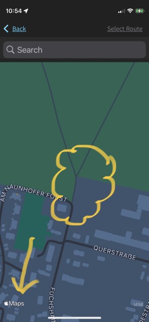
Ah OK, I guessed because of the displayed Logo the Elemnt App uses Apple Maps:
IMG_0028.jpeg
Btw. clouded in there is the path from my video I should cycle as suggested by the Elemnt App.

Apparently not what you wanted, but if you choose a target on the device itself, does it use just the roads in your map?
Sometimes it is doing well (mainly short distances), sometimes the Roam does not want to calculate and is switching the display without switching the three button functions when I press "select" after found my target on the Roam map, sometimes there are error messages, sometimes the Roam is in a never ending recalculating loop when I intentionally leave the suggested route. I will do some tests this weekend with screencapturing for better issue explanation.
 
Zuletzt bearbeitet:

Anzeige

Re: Aktuelles Kartenmaterial für Wahoo ELEMNT BOLT, ROAM, ELEMNT selbst generieren
:daumen: Not that I/we can do a lot about the routing results I think but it's good to know your experiences.
btw, in your case the maps are apple maps but the route comes, again as far as I know, from a different service.
 
Here's some screencapture stuff (the first three videos only, the second three tomorrow due to some youtube upload limits), perhaps a bit boring and large:

"take me to start" via Roam with some large detours in routing to start of the selected Komoot route

intentionally cycling off the Komoot route with no rerouting back on track but some rerouting into a dead road

intentionally cycling off the Komoot route again with no rerouting back on track (empty cue sheet), abort & restart route (filled cue sheet, but still no rerouting)

There are some major issues herein:
  • Seems the Roam primarily prefers bicycle ways and secondary roads for navigation instead of the shortest / fastest / balanced routing by using typically roads for road cycling, although the Roam is set to "Road".
  • "Take me to" via Roam fails in case of long distances to route (related screencaptures will come tomorrow).
 
Zuletzt bearbeitet:
@*cl* thanks for all the work and information.

I contacted someone with more knowledge about the Wahoo firmware, he also has an unobfuscated version of one. But he confirmed it will not be possible to change the routing calls made...
The firmware is signed (changing will make it stop working) and the routing parts are in a compiled c .so file.

So I guess it is not what you hoped for. (the guy I asked is actually quite happy with my routing tiles, but he is also the only one I heard say that sofar).

Maybe a last question: Do these self made tiles do better/worse than the original in your feeling/experience?
 
Zuletzt bearbeitet:
Maybe a last question: Do these self made tiles do better/worse than the original in your feeling/experience?
I will run two final tests:
  • one with your routing tiles from onedrive
  • one with the original Wahoo routing tiles
and share my experiences here.

For my self-made routing tiles, the Roam can't perform well with.

And I consider in case of real navigation the Roam isn't suitable coded for 100% road cycling. That's quiet pity.
 
I will run two final tests:
  • one with your routing tiles from onedrive


Both videos show the same take-me-to navigation initialised from the Roam directly (not the app). The route calculation is much more stable than with my self-made-maps. But the routing and rerouting results are non-road-cycling like too, and as can be seen in the videos too circuitous.
 
I see what you mean, the destination is near and the (re)routing takes you in the other direction for some reason!!

It's frustrating I can't try anything myself. Yesterday, on a pc, I tried to modify the routing-options.json file with a costing option (shortest=true, should/could influence the routing) the but that did not seem to work. But it might be it would work on the device itself. According to the person who knows more about the firmware it first checks this json file and if no options are found it uses its own defaults. Don't know if that is correct or not and I can't test.
Hi, my experience is that rerouting always takes you to the first missed waypoint, even the the next waypoint behind the missed one is more close to your current location.

Maybe that the issue that the first missed waypoint is behind you?
 
May be. I don't know the local situation of course but even in the first example which I assume is just the created route it seems like "the long way home" instead of the shortest?

@*cl* would you mind sharing the start and endpoint coordinates/location?
Just out of curiosity I would like to try on my pc. Try to see if the Wahoo call is to "blame" or that it is just what valhalla makes of it
 
@*cl* would you mind sharing the start and endpoint coordinates/location?
Just out of curiosity I would like to try on my pc. Try to see if the Wahoo call is to "blame" or that it is just what valhalla makes of it
start (51.2853497, 12.3466594)
end (51.1742037, 12.2499562)
 
Funktioniert bei euch Summit Freeride mit dem Custom-Map-Material oder geht es nur mit den original Wahoo-Karten?
 
Just to make it a bit clearer I hope.
The custom map files work, no problem there. But the new freeclimb function does not like the custom routing files. I am trying to get this to work too but no luck so far.
At this moment if you are on a roam or bolt 2. Install the Wahoo maps using the companion app (routing comes along with it) and after that overwrite just the maps with the custom maps.
This will give you the benefits of new maps and themes but will use the original routing tiles for on device routing and the freeride function. It will just not route you over new roads.
Apparently, if you have a roam or bolt 2 and try to use the custom routing tiles it can crash.

No need to check out the test versions of the routing tiles, they don't work (for freeride) and are probably incomplete in country border area's too.
 
For those interested, new maps and routing tiles are up for Germany and The Netherlands with Great-Britain uploading atm.
The routing tiles should be summit freeride compatible. Please test and let me know if it works as expected on all routing capable devices. Please test if freeride works and if the Roam 1, which I believe does have routing but no freeride, works with them. The files can be found here https://onedrive.live.com/?authkey=!AM8e4ViJIHdmOyU&id=F4E28DC020FD3904!136&cid=F4E28DC020FD3904
 
Danke @Ebe66 - geladen und morgen früh auf einen kleinen Anstieg. Werde berichten.

Wer hat den noch dieses Valhalla am laufen? Wie aufwendig ist es? Docker auf qnap und ubuntu hätte ich wohl.

kette rechts und unfallfreies fahren
 
:daumen:
Wer hat den noch dieses Valhalla am laufen? Wie aufwendig ist es? Docker auf qnap und ubuntu hätte ich wohl.
Ist komplett anders als beim WahooMapsCreator, und ganz verstanden bis ins Detail habe ich die valhalla.json bspw. noch nicht. Docker und ein Linux sind schon mal gut, ich hatte es auf MacOS laufen, @Ebe66 auf Windows. Ich wollte ja Routingtiles mit ausschließlich asphaltierten Straßen basteln, da mich die Navigation über Feldwege und andere unbefestigte Wege beim Rennradfahren massiv stört.
 
Zurück